Iceland’s iconic Laugavegur Trail is a breathtaking 55-kilometer journey through some of the most awe-inspiring landscapes on Earth, the Icelandic highland. From the vibrant hues of Landmannalaugar’s rhyolite mountains to the tranquil valleys of Þórsmörk, this trail promises an unforgettable experience for outdoor enthusiasts.
In this guide, we’ll delve into everything you need to know to make the most of your Laugavegur adventure, including essential trail information, the best times to hike, how to get there with a rental car, packing tips, accommodation choices, and a detailed day-by-day Iceland itinerary. Whether you’re a seasoned hiker seeking a new challenge or a nature lover craving an immersive wilderness experience, join us as we explore Iceland’s Laugavegur Trail.

Basic Information About the Laugavegur Hiking Trail
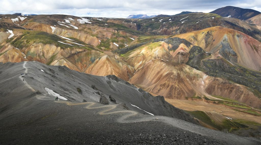
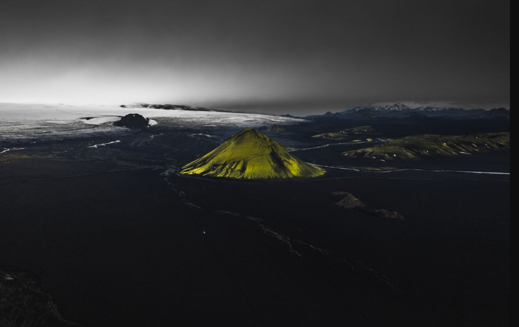
The Laugavegur Trail is one of the most popular hiking trails in Iceland, and for good reason! It’s a 55-kilometer (34-mile) trek through some of Iceland’s most stunning scenery, from the colorful rhyolite mountains of Landmannalaugar to the lush valleys of Þórsmörk.
The Laugavegur trail is only accessible from late June to mid-September due to Iceland’s unpredictable weather conditions. The exact dates can also depend on when the Icelandic Road Authority opens the Iceland F-roads that lead to the trailhead and some of the huts along the route. These roads are closed during the winter months when conditions become dangerous.
The Laugavegur trail is considered to be a moderate hike, but it’s important to be in good physical condition. The terrain is varied, with some river crossings and sections that can be quite steep. The weather can also be unpredictable, so be prepared for anything.
The Laugavegur Trail itself typically takes 4-6 days to complete, depending on your pace and how often you stop to enjoy the scenery. There are mountain huts spaced along the trail where you can stay overnight.
If you’re looking for a longer challenge, you can extend the Laugavegur trail by hiking the Fimmvörðuháls Trail. This 25-kilometer (15.5-mile) trail takes you from Þórsmörk to Skógar on Iceland’s south coast, passing by the iconic Skógafoss waterfall. Allow an additional 1-2 days to complete this extension. The total length of the Laugavegur Trail with the Fimmvörðuháls extension is 80 kilometers (50 miles).
Laugavegur + Fimmvörðuháls complete trail map (79.5 km total)
The best time to do this hiking trail
The best time to hike the Laugavegur Trail depends on what you prioritize: weather, crowds, or daylight hours; however, mid-June until August is the optimal time of year. July is generally considered the sweet spot for Laugavegur. You’ll experience the best weather conditions with warmish temperatures (around 10-13°C or 50-55°F) and the phenomenon of the Iceland midnight sun, allowing you to hike for longer periods without needing darkness for rest. However, July is also peak season, so expect more crowds on the trail.
If you prefer fewer crowds, late June offers a chance to experience good weather similar to July but with potentially fewer fellow hikers. However, there’s also a possibility that the trail or access roads might not be fully open yet due to lingering snow from winter. Heading into early September, the shoulder season can present good deals on accommodation and potentially less crowded trails. However, the days get shorter, and there’s a higher chance of encountering unpredictable weather conditions like rain and strong winds.
How Can You Get To the Hiking Starting Point With a Rental Car?
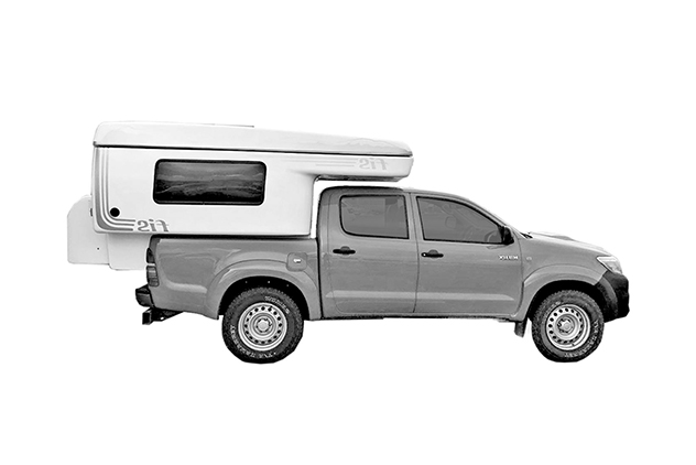
The Laugavegur trail starts at Landmannalaugar, a remote location accessible only by car. Icelandic law requires a four-wheel drive vehicle to navigate the rough F-roads leading to Landmannalaugar. Regular cars simply won’t handle the terrain. River crossings are also common on the route, so it’s important that drivers are confident in their ability to navigate river crossings, along with experience driving on gravel roads.
To get to the hike starting point from Iceland’s capital, Reykjavik, you’ll need to head south out of the city on the Route 1 Ring Road for about 160 kilometers (100 miles). The last gas stations you’ll have access to before hitting F-roads are in Selfoss, so make sure you fill up on gasoline.
From here, you will turn off on Route 30, also known as the Highland Road, which begins as a paved road but eventually transitions to gravel. On this road, you’ll pass Hekla volcano, before turning off onto another gravel road and traversing the Nýjahraun lava fields before reaching Landmannalaugar, which marks the beginning of the trail.

Alternative transportation options
While the challenge and satisfaction of self-driving to the Laugavegur trailhead is part of the adventure, there are some alternative transportation options that might better suit your needs. A guided tour is the most hassle-free option, with tour operators taking care of everything, including transportation from Reykjavik to Landmannalaugar, accommodation in mountain huts along the trail, meals, and even permits.
However, keep in mind that guided tours can be more expensive than self-guided trips. Additionally, you might have less flexibility in terms of pace and itinerary compared to exploring on your own.
Bus companies will also offer Hikers’ bus passes, which are valid for a direct ride from Reykjavik to the starting point that you choose (Thórsmork, Landmannalaugear, and Skógar), along with a ride back to Reykjavik from your chosen end point.
What Should You Bring For This Trip?
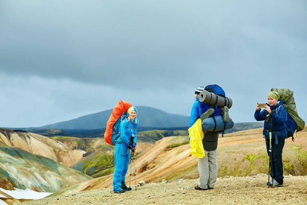
Packing for the Laugavegur Trail requires careful consideration of Iceland’s unpredictable weather and the multi-day hut-to-hut nature of the hike. Here are some essentials to keep in mind:
- Waterproof shell jacket and pants: Icelandic weather can change rapidly, so a good quality waterproof shell is vital.
- Thermal base layers: Merino wool is ideal for its warmth and wicking properties, even when wet.
- Quick-drying hiking pants: Convertible pants with zip-off legs can be handy for river crossings.
- Warm fleece jacket: Crucial for evenings and potentially colder weather conditions.
- Long-sleeved shirts and T-shirts: Choose breathable, quick-drying fabrics.
- Warm hat, gloves, and buff: Stay warm and protected from the elements.
- Underwear and socks: Pack enough pairs for the duration of your hike, with wool socks being a good option for warmth and moisture management.
- Waterproof hiking boots with good ankle support: Essential for navigating uneven terrain and river crossings. Ensure they’re well-worn in to avoid blisters.
- Backpack: Choose a sturdy backpack with a comfortable fit and appropriate size for your belongings (40-60 liters is typical).
- Sleeping bag: A lightweight sleeping bag rated to at least 0°C (32°F) is recommended, depending on the season. Some huts offer sleeping bag liners for rent.
- Water bottle or hydration bladder: Stay hydrated throughout the hike.
- Headlamp: Essential for nighttime use in the huts or for pre-dawn starts.
- First-aid kit: Be prepared for minor injuries or blisters.
- Swimsuit: If you plan on taking a dip in the geothermal hot springs at Landmannalaugar.
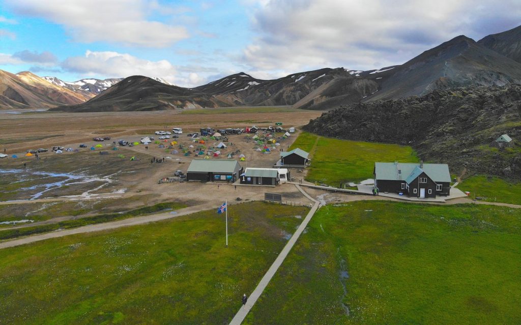
Where To Stay Overnight?
The Laugavegur trail is a hut-to-hut trek, meaning you’ll spend your nights in mountain huts scattered along the trail. These huts provide a welcome respite after a day of hiking, offering basic amenities and a chance to rest and recharge before continuing your journey.
Huts are strategically positioned at intervals along the Laugavegur trail, typically a day’s hike apart. This makes it convenient to break up your journey and find accommodation each night. While the level of amenities varies between huts, most offer dormitory-style sleeping quarters with bunk beds, basic kitchen facilities, toilets, and water.
Reservations are essential as spaces in the huts fill up quickly. You’ll need to book your spots as far in advance as you can to ensure you get a bed, especially during July and August. You can make reservations online or through park authorities in Iceland.
Tent camping in Iceland is also an option, but designated campsites are scarce. Most camping is permitted near the mountain huts, but there are restrictions in some areas to protect the fragile environment. Additionally, you’ll have to carry all your camping gear with you, and facilities and amenities will be very limited. Staying in the mountain huts is the most recommended option when hiking the Laugavegur trail.
Laugavegur Trail: Day 1 Landmannalaugar to Hrafntinnusker
Day 1 on the Laugavegur Trail will take you from Landmannalaugar to Hrafntinnusker. This section of the route is about 12 kilometers (7.4 miles) and takes between four to five hours. Starting at the colorful rhyolite mountains of Landmannalaugar, the trail ascends through lava fields and steaming vents, offering stunning views of the multicolored mountains and glaciers in the distance.
You’ll likely encounter the first river crossing on this day, along with many geysers, including Stórihver. The difficulty is moderate, as the initial ascent can be challenging, with an elevation gain of around 500 meters (1,640 feet). The terrain is a mix of gravel paths, volcanic rock, and some snow patches, depending on the season.
Day 1 Landmannalaugar to Hrafntinnusker route map
What to expect to see on day 1?
On the first day, as you ascend from the geothermally active valley of Landmannalaugar, enveloped by the remarkable spectrum of the rhyolite mountains, the trail offers not just a visual feast but also a physical test. This initial stretch, dense with volcanic phenomena, includes passing by soothing hot springs ideal for a brief respite.
The presence of these springs, amidst the rugged backdrop, provides a surreal hiking experience, juxtaposing the earth’s heat with the coolness of the Icelandic air. As you trek through this dynamic landscape, your journey is punctuated by the sights and sounds of bubbling geysers, notably Stórihver, providing a vivid reminder of the land’s volcanic activity.
Laugavegur Trail: Day 2 Hrafntinnusker to Álftavatn
Day 2 on Iceland’s Laugavegur Trail will take you from Hrafntinnusker to Álftavatn. This section of the route is also 12 kilometers (7.4 miles) and takes between four to five hours. The trail continues across black ash fields and past the obsidian Helgafell mountain.
You might encounter more snow patches in the early season. The terrain is much flatter and easier to navigate than Day 1, but there may be some sections with loose gravel and uneven terrain.
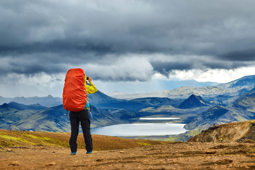
Once you reach the edge of Jökultungur mountaintop, you’ll have the opportunity to see three of the country’s glaciers, Mýrdalsjökull, Eyjafjallajökull, and Tindfjallajökull. Make sure you also keep an eye out for Iceland’s diverse birdlife along the way. As you descend, you’ll come to Grashagakvísl river, which you will likely need to wade through.
Day 2 Hrafntinnusker to Álftavatn route map
What to expect to see on day 2?
The journey continues across the stark contrast of black ash fields, which serves as a reminder of Iceland’s fiery underbelly. This passage near the obsidian-laden Helgafell mountain offers a tactile sense of Iceland’s volcanic foundation.
As you navigate this flatter segment, the horizon expands to include prominent glaciers, fostering a sense of accomplishment with each step towards the Álftavatn area. Reaching Jökultungur, the panoramic views of the surrounding glaciers serve as a reward for the trek’s challenges thus far, providing not just a visual treat but a cooling breeze off the ice fields.
Laugavegur Trail: Day 3 Álftavatn to Emstrur (Botnar)
Day 3 will be the journey from Álftavatn to Emstrur, which is approximately 15 kilometers (9.3 miles) and will take between six and eight hours to complete.
This is the longest stretch so far, so make sure you get an early start. The path winds through green valleys and past the turquoise Lake Álftavatn. You are very likely to encounter river crossings on this day, so prepare to get wet! You’ll reach the Hvanngil Valley about an hour into the hike, where there is another mountain hut.
From there, you’ll cross both the Kaldaklofskvísl and Bláfjallakvísl rivers. Despite the river crossings, the terrain is relatively flat, with some rolling hills. Throughout the day, you’ll experience a change in scenery from the desert-like terrains to lush green valleys, colorful rhyolite mountains, and glacial lakes. Be on the lookout for Iceland’s unique flora and fauna as you navigate your way to the Botnar huts in Emstrur.
Day 3 Álftavatn to Emstrur (Botnar) route map
What to expect to see on day 3?
As you depart from the serene Álftavatn lake, the trail weaves through varying elevations and vibrant valleys, introducing more frequent river crossings that test your resilience and readiness.
This segment offers a blend of tranquility and adventure, as the verdant valleys transition into the austere beauty of the black sand desert of Mælifellssandur, contrasting sharply with the occasional vibrant burst of wildflowers along the path. The Botnar huts at Emstrur mark the end of this day’s journey, providing a modest yet welcoming refuge in the vastness of the Icelandic wilderness.
Laugavegur Trail: Day 4 Emstrur to Þórsmörk
The final day is another long trek from Emstrur to Þórsmörk. This is approximately 15 kilometers (9.3 miles) again and will take between six and eight hours with both ascents and descents. Hikers will cross the Syðri-Emstruá River gorge and enter the green valley of Þórsmörk, where you can expect wildflowers, moss-covered rocks, and dwarf birch trees. This final stretch is moderate to challenging, with the terrain uneven in some parts and steeper sections.
The final river crossing at the Markarfljót River can be one of the most challenging of the entire hike, depending on the water flow, but you’ll be rewarded by reaching the finishing point at the Básar campsite in Þórsmörk, where you can rest and reflect on your journey surrounded by stunning scenery. Básar is nestled in a picturesque valley, providing a perfect setting to relax and unwind after days of hiking.
Day 4 Emstrur to Þórsmörk route map
What to expect to see on day 4?
Your final day’s trek to Þórsmörk is a culmination of all the elements of the Icelandic highlands, featuring both rigorous ascents and descents. Crossing the formidable Syðri-Emstruá River gorge offers a moment of awe amidst the challenges, leading you into the embrace of Þórsmörk’s verdant valley.
This section is rich in diverse flora, including wildflowers and dwarf birch trees, providing a lush contrast to the earlier stark landscapes. As you cross the final river at Markarfljót, the sense of nearing the journey’s end grows. Básar campsite awaits to offer rest amidst its picturesque setting, a fitting conclusion to a remarkable trek
Extensionto Skógar (the Fimmvörðuháls trail)
For those who want a little more, the Laugavegur trail can be extended by continuing on the Fimmvörðuháls trail, ultimately leading you to the southern coast of Iceland and the village of Skógar. The Fimmvörðuháls trail itself is roughly 25 kilometers (15.5 miles) long. Adding this to the Laugavegur trail makes for a total distance of around 42-43 kilometers (26-27 miles), depending on the exact route you take.
Fimmvörðuháls trail route from Þórsmörk to Skógar
Attempting the Fimmvörðuháls trail extension requires a good level of fitness due to the increased distance and challenging terrain. Keep in mind there are also no mountain huts along this section of the route, so you will need to camp overnight in a tent.
The Fimmvörðuháls trail is generally considered more challenging than the Laugavegur trail. The terrain is more rugged with steeper ascents and descents, and some sections might involve snowfields depending on the season.
The trail offers dramatic views with volcanic craters, colorful mountains, glaciers, and waterfalls cascading down moss-covered cliffs. You’ll traverse the Fimmvörðuháls pass, a high point between two glaciers, providing panoramic views of the surrounding landscape.
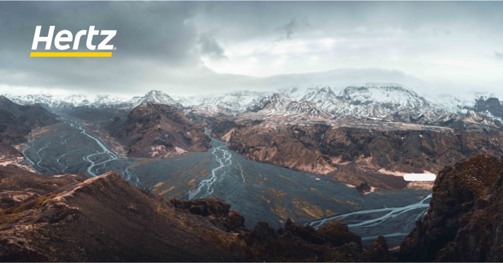
Explore the Laugavegur Trail in Iceland
Embarking on the Laugavegur Trail is an experience like you won’t find anywhere else, offering a chance to fully immerse yourself in Iceland’s stunning natural beauty and rugged landscapes. To make the most of your adventure, ensure you have the freedom and flexibility to explore at your own pace by booking a rental car with Hertz Iceland. With Hertz Iceland, you’ll have the convenience and reliability you need to access the trailhead at Landmannalaugar and embark on an unforgettable journey through Iceland’s wilderness.